
搜索结果: 1-15 共查到“Scales”相关记录228条 . 查询时间(0.062 秒)
Estimating Carbon Sequestration Potential of Forest and Its Influencing Factors at Fine Spatial-Scales: A Case Study of Lushan City in Southern China
fine-scalebiomass expansion factortree growth equationcarbon sequestration potentialsite characteristics
2023/11/20
Accurate prediction of forest carbon sequestration potential requires a comprehensive understanding of tree growth relationships. However, the studies for estimating carbon sequestration potential con...

Gravitational waves, like the discovery of the Higgs boson in 2012, have made their mark on a decade of extraordinary discoveries in physics. Unlike gravity, which is created when massive objects leav...

If you brush against the wings of a butterfly, you will likely come away with a fine sprinkling of powder. This lepidopteran dust is made up of tiny microscopic scales, hundreds of thousands of which ...
Forest management optimization across spatial scales to reconcile economic and conservation objectives
DEAD-WOOD BIODIVERSITYCONSERVATION FINLAND MULTIFUNCTIONALITY
2024/2/27
Conflicts between biodiversity conservation and resource production can be mitigated by multi-objective management planning. Optimizing management for multiple objectives over larger land areas likely...
2018极限科学研讨会(Workshop on Science at Extreme Scales: Where Big Data Meets Large-Scale Computing Tutorials)
2018 极限科学 研讨会
2017/12/20
The program opens with four days of tutorials that will provide an introduction to major themes of the entire program and the four workshops. The goal is to build a foundation for the participants of...

Rethinking Well-being and Sustainability Measurements from Local to Global Scales(图)
Rethinking Well-being Sustainability Measurements Local Global Scales
2017/10/26
A new study suggests that standard ways of measuring well-being and sustainability in communities used by global organizations may be missing critical information and could lead to missteps in managem...
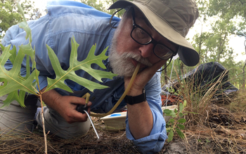
10 new awards support ecological research at regional to continental scales(图)
10 new awards ecological research regional to continental
2017/9/5
The National Science Foundation (NSF) has issued 10 new awards, worth a total of $12.2 million, through its MacroSystems Biology and Early NEON (National Ecological Observatory Network) Science progra...
2017年小规模操纵、自动化和机器人技术国际会议(2017 International Conference on Manipulation, Automation and Robotics at Small Scales)
2017年 小规模操纵 自动化 机器人技术 国际会议
2017/6/23
MARSS, the annual International Conference on Manipulation, Automation and Robotics at Small Scales, will be held for the second time from 17 to 21 July, 2017 in Montréal, Canada. This recently establ...
REMOTE SENSING TECHNIQUES TO ASSESS POST-FIRE EFFECTS AT THE HILLSLOPE AND SUB-BASIN SCALES VIA MULTI-SCALE MODEL
Multiscale model log-Gaussian Cox processes hillslope micro-topography post-fire environment
2017/7/12
Post-fire environmental footprint is expected at varying scales in space and in time and demands development of multi-scale monitoring approaches. In this paper, a spatially and temporally explicit mu...
MONITORING LAND COVER DYNAMICS AT VARYING SPATIAL SCALES USING HIGH TO VERY HIGH RESOLUTION OPTICAL IMAGERY
Land Cover Agriculture Optical High Resolution
2016/12/1
Activities have focused on using the Landsat time-series and Sentinel-2 datasets to monitor land cover dynamics across the United Kingdom, with mapping of specific areas including missions such as Wor...
MONITORING TREE POPULATION DYNAMICS IN ARID ZONE THROUGH MULTIPLE TEMPORAL SCALES:INTEGRATION OF SPATIAL ANALYSIS,CHANGE DETECTION AND FIELD LONG TERM MONITORING
Spatial analysis Change detection Long-term monitoring Arid Acacia trees Remote sensing
2016/11/23
High mortality rates and lack of recruitment in the acacia populations throughout the Negev Desert and the Arava rift valley of Israel have been reported in previous studies. However, it is difficult ...
NSF awards $15.9 million to foster new understanding of biological systems on regional to continental scales
NSF $15.9 million biological systems regional continental
2016/9/29
Have you looked closely at a stream, lake or woodland and observed changes in it over time? That's exactly what scientists are trying to do on a larger, regional-to-continental scale -- a macrosystems...
GROUND SURFACE VISUALIZATION USING RED RELIEF IMAGE MAP FOR A VARIETY OF MAP SCALES
Ground surface RRIM Visualization
2016/7/8
There are many methods to express topographical features of ground surface. In which, contour map has been the traditional method and along with development of digital data, surface model such as shad...
DISCRIMINATING SPECIES USING HYPERSPECTRAL INDICES AT LEAF AND CANOPY SCALES
Imaging Spectroscopy Spectral Indices Species Discrimination Leaf and Canopy Remote Sensing
2015/12/31
Developments in hyperspectral remote sensing have provided new indices or indicators of biochemical and biophysical properties. Most of the studies involving the novel spectral indices have been condu...
ASSESSMENT OF ECOSYSTEM CLASSIFICATION SYSTEMS AT VARIOUS SCALES ON ENVIRONMENTAL PARAMETERS USING REMOTE SENSING TECHNIQUES
Remote Sensing Ecosystem Classification Scale
2015/12/26
The main purpose of this study was to assess the effect of ecosystem classification systems at various scales on environmental parameters using remote sensing techniques. The processes included applyi...