搜索结果: 1-14 共查到“reconstruct”相关记录14条 . 查询时间(0.08 秒)


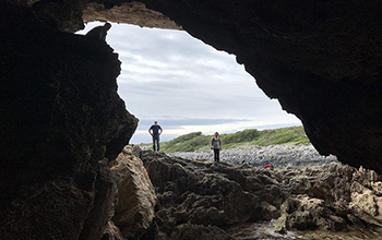
Geoscientists reconstruct 6.5 million years of sea level in the Western Mediterranean(图)
Geoscientists reconstruct 6.5 million years sea level Western Mediterranean
2021/2/5
The pressing concern posed by rising sea levels has created a need for scientists to predict how quickly the oceans will rise in coming centuries, researchers say. To gain insight into future ice shee...
Learning to Reconstruct: Statistical Learning Theory and Encrypted Database Attacks
Statistical Learning Theory Encrypted Database Attacks
2019/1/9
We show that the problem of reconstructing encrypted databases from access pattern leakage is closely related to statistical learning theory. This new viewpoint enables us to develop broader attacks t...
OU anthropologists reconstruct mitogenomes from prehistoric dental calculus
OU anthropologists prehistoric dental calculus
2016/4/13
Using advanced sequencing technologies, University of Oklahoma anthropologists demonstrate that human DNA can be significantly enriched from dental calculus (calcified dental plaque) enabling the reco...
Using Successive Censuses to Reconstruct the AfricanAmerican Population,1930-1990
Successive Censuses AfricanAmerican Population
2016/3/18
The Census Bureau's program to estimate the completeness of decenn ial census counts for age, sex,and race groups relies principally upon what it terms "demographic an alysis." The essence of this app...
Memento: How to Reconstruct your Secrets from a Single Password in a Hostile Environment
Single Password Hostile Environment
2016/1/9
Passwords are inherently vulnerable to dictionary attacks, but are quite secure if guessing attempts can be
slowed down, for example by an online server. If this server gets compromised, however, the...
A Three-dimensional Error Model of DEM Based on the Reconstruct Contours
DEM contour line precision analysis three-dimensional model error mean square error
2015/12/3
In this paper, a three-dimensional error model of grid digital elevation model (DEM) is proposed based on the reconstructed contours. Though analyzing the construction of three-dimensional error model...
Tree-ring cellulose d18O variability in pine and oak and its potential to reconstruct precipitation and relative humidity in central Japan
tree-ring cellulose d18O pine oak precipitation relative humidity central Japan
2017/4/10
Oxygen isotope ratios (d18O) of tree-ring cellulose in pine (Pinus densiflora) and oak (Quercus serrate and Quercus
variabilis) growing in central Japan from 1970 to 2011 share a common inter-annual ...
COMBINED APPLICATION OF AEROPHOTOGRAMMETRY,LASER SCANNING AND DYNAMIC SEGMENTATION TO RECONSTRUCT THREE-DIMENSIONAL WATERCOURSE NETWORKS
Analytical and Digital Photogrammetry Airborne Laser Scanning Digital Terrain Model GIS, Dynamic Segmentation Watercourse Networks
2015/2/3
The data generation of highly detailed digital terrain models including an integrated 3D watercourse network is a requirement of the extensive approval and monitoring process within the environmental ...

Scientists reconstruct genome of common ancestor of crocodiles, birds, dinosaurs(图)
Scientists reconstruct genome common ancestor crocodiles birds dinosaurs
2014/12/30
Crocodiles are the closest living relatives of the birds, sharing a common ancestor that lived around 240 million years ago and also gave rise to the dinosaurs. A new study of crocodilian ge...
COMPARISON BETWEEN LASER SCANNING AND AUTOMATED 3D MODELLING TECHNIQUES TO RECONSTRUCT COMPLEX AND EXTENSIVE CULTURAL HERITAGE AREAS
Close Range Photogrammetry Laser scanning Cultural Heritage Automated 3D modelling techniques
2014/4/25
In Cultural Heritage field, the necessity to survey objects in a fast manner, with the ability to repeat the measurements several times
for deformation or degradation monitoring purposes, is increas...
Near surface geophysics techniques and geomorphological approach to reconstruct the hazard cave map in historical and urban areas
Near surface geophysics techniques geomorphological approach the hazard cave map in historical and urban areas
2010/9/13
This work, carried out with an integrated methodological approach, focuses on the use of near surface geophysics techniques, such as ground penetrating radar and electrical resistivity tomography (ERT...
Artificial Neural Networks to reconstruct incomplete satellite data:application to the Mediterranean Sea Surface Temperature
Artificial Neural Networks incomplete satellite data Mediterranean Sea Surface Temperature
2009/10/30
Satellite data can be very useful in applications where extensive spatial information is needed, but sometimes missing data due to presence of clouds can affect data quality. In this study a methodolo...
RECOGNIZING MEANDERS TO RECONSTRUCT RIVER DYNAMICS OF THE GANGES
river metrics Landsat Ganges delta Bangladesh
2015/11/16
The long-term discharge evolution of branches of rivers can potentially be derived from inactive and fossil river meanders using
relations between discharge and channel width and meander dimensions....


