
搜索结果: 1-2 共查到“遥感地质学 Characterisation”相关记录2条 . 查询时间(0.115 秒)
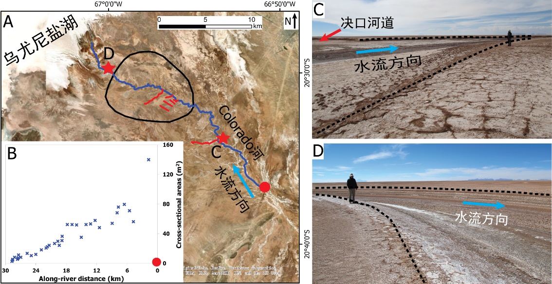
中国地质大学科学技术发展院李嘉光* 等,资源学院. Journal of Hydrology(2020), Digital Elevation Models for topographic characterisation and flood flow modelling along low-gradient, terminal dryland rivers: A comparison of spaceborne datasets for the Río Colorado, Bolivia(图)
精确表征;极低;缓河流;末端;地形;模拟河道;洪水;漫溢
2021/10/15
近日,国际知名期刊Journal of Hydrology在线刊发了中国地质大学资源学院李嘉光副教授团队在陆相湖盆边缘河流末端沉积体系研究的最新成果――Digital Elevation Models for topographic characterisation and flood flow modelling along low-gradient, terminal dryland rive...
DETERMINATION AND CHARACTERISATION OF FAULT SYSTEMS AND GEOMORPHOLOGICAL FEATURES BY RS AND GIS TECHNIQUES IN THE WSW PART OF TURKEY
Remote Sensing Geology Geomorphology Western Anatolia Earthquakes DEM/DTM Applications
2015/7/30
This article is aimed to give the first results of the project studying the faults and tectonic style of the southwestern part of Turkey
based on remote sensing techniques. LANDSAT-TM and ASTER sate...