搜索结果: 1-15 共查到“水文学 DATA”相关记录139条 . 查询时间(1.109 秒)
INTEGRATION OF SATELLITE, GLOBAL REANALYSIS DATA AND MACROSCALE HYDROLOGICAL MODEL FOR DROUGHT ASSESSMENT IN SUB-TROPICAL REGION OF INDIA
VIC Soil Moisture Agricultural drought SMDI CCI
2018/5/15
Change in soil moisture regime is highly relevant for agricultural drought, which can be best analyzed in terms of Soil Moisture Deficit Index (SMDI). A macroscale hydrological model Variable Infiltra...

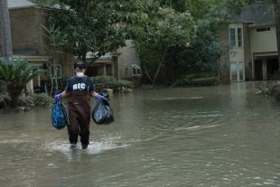
Decade of data shows FEMA flood maps missed 3-in-4 claims(图)
Decade data FEMA flood maps missed 3-in-4 claims
2017/9/20
An analysis of flood claims in several southeast Houston suburbs from 1999 to 2009 found that the Federal Emergency Management Agency’s 100-year flood plain maps — the tool that U.S. officials use to ...
A Method for Extracting Stream Channel Flow Paths from LiDAR Point Cloud Data
LiDAR Point Cloud Streams
2015/8/14
Traditional methods of delineating stream channel networks use gridded raster elevation data. Direct use of LiDAR point clouds, without first creating a raster or grid, could improve efficiency and ac...
Case Studies of Applying Urban Surface Data in Evaluating Stormwater Management Issues
Urban runoff impervious surfaces suspended solids stormwater management non-point source pollution
2015/8/13
Pollutant load estimation is often required to evaluate stormwater management issues associated with water quality and urban development. Land use (e.g. residential, commercial) is commonly employed a...
Modeling and Understanding the Relationship between Vegetation and Rainfall of a Tropical Watershed using Remote Sensing Data and GIS
NDVI rainfall modelling calibration verification
2015/8/13
A model is developed to understand the relationship between satellite-derived NDVI and rainfall data in a large tropical catchment. Two Fourier-based modeling techniques with a seasonal component, viz...
Evaluation of the Wetland Mapping Methods using Landsat ETM+ and SRTM Data
wetlands remote sensing mapping delineation automated methods semi-automated methods Limpopo river basin
2015/8/13
Overarching goal of this paper was to evaluate automated and semi-automated methods of mapping wetlands using Landsat ETM+ and SRTM data. Automated methods consisted of: (a) slope derived from SRTM, (...
Estimation of aquifer hydraulic characteristics from electrical sounding data: the case of middle Imo River basin aquifers, south- eastern Nigeria
Aquifer hydraulic characteristics Dar - Zarrouk parameters
2015/8/11
We have used the concept of Da - Zarrouk parameters (transverse unit resistance (R) and longitudinal conductance (C)) in porous media to determine aquifer hydraulic characteristics within the middle I...
Performances of Stochastic Approaches in Generating Low Streamflow Data for Drought Analysis
monthly-minimum daily discharge stochastic model ARIMA Thomas-Fiering
2015/8/11
This study analyzed the monthly-minimum daily discharge data of each month from three gauge stations on Cekerek Stream for forecasting using stochastic approaches. Initially non-parametric test (Mann-...
Assessment of the Impact pf Mining on Agricultural Land using Erosion-Deposition Model and Space Borne Multispectral Data
Mining Agricultural Land Erosion-Deposition Model Space Borne Multispectral Data
2015/8/6
Since erosion of mine overburden and mine dump leads to its deposition down the slope in the catchment, an attempt was made to study the erosion-deposition pattern in a micro watershed in part of Goa ...
Improving overland flow routing by incorporating ancillary road data into Digital Elevation Models
Watershed Delineation Road Geographic Information System GIS Flow Direction Digital Elevation Model DEM Hydrological Modeling
2015/8/6
Roads, ditches, and culverts influence hydrological and geomorphological processes significantly. However, most hydrological models continue to rely solely on regional digital elevation models (DEMs) ...
Application of Chemical Mass Balance to Water Quality Data of Malaprabha River
Mass balance Salinity advection base flow
2015/8/6
Mass balance calculations carried out for Na, K, Ca, Mg, Cl, SO4 and HCO3 for the study area showed that the major source of contamination is through non-point sources. It is also observed that the ri...
CAN SINGLE EMPIRICAL ALGORITHMS ACCURATELY PREDICT INLAND SHALLOW WATER QUALITY STATUS FROM HIGH RESOLUTION, MULTI-SENSOR, MULTI-TEMPORAL SATELLITE DATA?
Landsat Reflectance Earth observation Monitoring
2015/5/7
Assessing and monitoring water quality status through timely, cost effective and accurate manner is of fundamental importance for numerous environmental management and policy making purposes. Theref...
REMOTE SENSING DATA ASSIMILATION IN WATER QUALITY NUMERICAL MODELS FOR SIMULATION OF WATER COLUMN TEMPERATURE
data assimilation numerical model water temperature
2015/1/16
Numerical models are important tools for simulating processes within complex natural systems, such as hydrodynamics and water quality processes within a water body. From decision makers’ perspectives,...
A Method for Extracting Stream Channel Flow Paths from LiDAR Point Cloud Data
Streams Channels Delineation
2015/1/9
Traditional methods of delineating stream channel networks use gridded raster elevation data. Direct use of LiDAR point clouds, without first creating a raster or grid, could improve efficiency and ac...
Evaluation of the Wetland Mapping Methods using Landsat ETM+ and SRTM Data
wetlands remote sensing mapping, delineation
2015/1/7
Overarching goal of this paper was to evaluate automated and semi-automated methods of
mapping wetlands using Landsat ETM+ and SRTM data.
Automated methods consisted of: (a) slope derived from SRTM,...

