搜索结果: 1-15 共查到“工学 3-D visualization”相关记录197条 . 查询时间(0.046 秒)

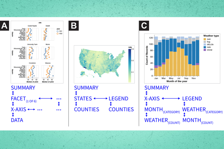
Making data visualization more accessible for blind and low-vision individuals(图)
盲人 低视力人士 数据可视化
2023/6/20
DEVELOPMENT OF VIRTUAL REALITY APPLICATION FOR CULTURAL HERITAGE VISUALIZATION FROM MULTI-SOURCE 3D DATA
Virtual Reality Visualization Cultural heritage Multi-source data
2019/3/1
Immersive technologies like Virtual or Augmented Reality (VR/AR) are lately becoming more and more popular in wide range of scientific applications. These technologies provide the most immersive way t...
OPTIMIZED ORGANIZATION AND ADAPTIVE VISUALIZATION OF COMPLICATED MOUNTAIN DISASTER 3D SCENES FOR DIVERSE TERMINALS
Mountain Disaster 3D Scenes Adaptive Visualization
2018/11/9
Mountain disaster scenes usually contains various geographical entities, which are dynamic and complicated. Therefore, the construction of mountain disaster 3D scenes has great significance for disast...
DYNAMIC 3D VISUALIZATION OF FLOODS: CASE OF THE NETHERLANDS
Floods 3D visualization CityJSON Cesium 3D webglobe
2018/11/9
In this paper, we review state of the art 3D visualization technologies for floods and we focus on the Netherlands since it has a long history of dealing with floods and developing information technol...
VISUALIZATION AND ANALYSIS OF CELLULAR & TWITTER DATA USING QGIS
QGIS, Twitter feed, Cellular data, Origin Destination Matrices, Thematic maps
2018/11/8
The study is to understand individual presence and movement in Friuli Venezia Giulia region. It is important for tourism planning, hazard management, business marketing, implementing government lifeti...
ADDING 3D GIS VISUALIZATION AND NAVIGATION TO THE SPARQL QUERY LOOP
3D visualization, geospatial data, Linked Data, SPARQL, REPL, data analytics
2018/11/8
3D environments allow advanced spatial navigation and visualization, but have traditionally provided limited support for performing non-spatial data analysis operations like filtering, joining, and in...
COMBINING INDEPENDENT VISUALIZATION AND TRACKING SYSTEMS FOR AUGMENTED REALITY
augmented reality pose estimation tracking calibration visualization
2018/6/4
The basic requirement for the successful deployment of a mobile augmented reality application is a reliable tracking system with high accuracy. Recently, a helmet-based inside-out tracking system whic...
ARCHITECTURAL HERITAGE VISUALIZATION USING INTERACTIVE TECHNOLOGIES
Heritage Visualization 3D Modelling Augmented Reality HBIM
2017/8/30
With the increased exposure to tourists, historical monuments are at an ever-growing risk of disappearing. Building Information Modelling (BIM) offers a process of digitally documenting of all the fea...
GEOSPATIAL DATA PROCESSING FOR 3D CITY MODEL GENERATION, MANAGEMENT AND VISUALIZATION
aerial imagery 3D building models 3D city model mesh 3D geo-database web-GIS smart city
2017/7/13
Recent developments of 3D technologies and tools have increased availability and relevance of 3D data (from 3D points to complete city models) in the geospatial and geo-information domains. Neverthele...
In the previous years, research in environmental sciences has become more and more important as we are faced with increasing problems concerning climate change, water scarcity, pollution of the enviro...
PHOTOGRAMMETRIC TECHNIQUES FOR ANALYSIS AND VISUALIZATION OF CHANGES IN 2D AND 3D DATA: PLASTIC SURGERY APPLICATION
Photogrammetry 3Dreconstruction shape changes visualization human body texturing data fusion
2017/6/19
Accurate measurements of 3D scenes and change detection of spatial distributed data are of great importance in different areas of research and application. For more accurate data analysis it is useful...
4D RECONSTRUCTION AND VISUALIZATION OF CULTURAL HERITAGE: ANALYZING OUR LEGACY THROUGH TIME
4D Modelling Cultural Heritage Data Fusion Monitoring Visualization
2017/4/7
Temporal analyses and multi-temporal 3D reconstruction are fundamental for the preservation and maintenance of all forms of Cultural Heritage (CH) and are the basis for decisions related to interventi...
2017年IEEE亚太地区可视化会议(2017 IEEE Pacific Visualization Symposium )(PacificVis)
2017年 IEEE亚太地区可视化 会议
2017/3/27
The 10th IEEE Pacific Visualization Symposium (PacificVis 2017) will be held at Hoam Faculty House, Seoul National University, Seoul, Korea during April 18 to 21, 2017. As part of PacificVis, workshop...
第七届国际3D虚拟重建和复杂建筑可视化研讨会(7th International Workshop on 3D Virtual Reconstruction and Visualization of Complex Architectures)
第七届 3D虚拟重建 复杂建筑 可视化 研讨会
2017/1/18
3D-ARCH is a series of international workshops which started in 2005 in Venice and move throughout the years to Zurich (2007), Trento (2009, 2011, 2013) and Avila (2015), organized as an ISPRS and CIP...
3D VISUALIZATION OF VOLCANIC ASH DISPERSION PREDICTION WITH SPATIAL INFORMATION OPEN PLATFORM IN KOREA
Visualization Volcanic ash Disaster prediction Spatial information Open platform
2016/11/30
Visualization of disaster dispersion prediction enables decision makers and civilian to prepare disaster and to reduce the damage by showing the realistic simulation results. With advances of GIS tech...


