搜索结果: 1-15 共查到“工学 improving”相关记录139条 . 查询时间(0.14 秒)


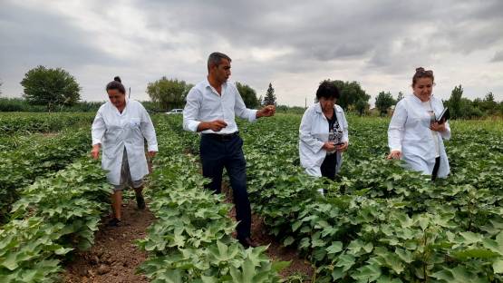
Climate-Smart Agriculture Shows Promise in Improving Azerbaijan’s Cotton Productivity(图)
气候智能 农业 阿塞拜疆 棉花 生产力
2023/3/16

MIT engineers devise a recipe for improving any autonomous robotic system(图)
自主机器人系统 通用优化器 步行机器人 自动驾驶汽车
2023/6/20
Improving enzymatic hydrolysis of acid-pretreated bamboo residues using amphiphilic surfactant derived from dehydroabietic acid
Amphiphilic surfactant Bamboo Acid pretreatment Enzymatic hydrolysis Lignin adsorption site
2024/3/5
In this work, amphiphilic surfactant was obtained using dehydroabietic acid from pine rosin and then preadsorbed with acid-pretreated bamboo residues (AP-BR) to block the residual lignin adsorption si...

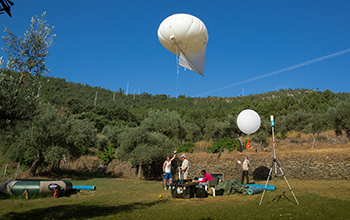
Scientists have released the first of several reports with findings that could help officials manage wind power facilities more efficiently and increase renewable energy production.Results from the pr...
IMPROVING PATH QUERY PERFORMANCE IN PGROUTING USING A MAP GENERALIZATION APPROACH
pgRouting Road Networks Skeletal Model Skeleton Shortest Path Map Generalization Zones Path Computation
2018/11/8
pgRouting library provides functions to compute shortest path between any two points of a road network which is of great demand and also a topic of interest in the field of GIS, graph theory and trans...
IMPROVING THE INTEROPERABILITY OF DISASTER MODELS: A CASE STUDY OF PROPOSING FIREML FOR FOREST FIRE MODEL
FireML Forest Fire Model 3DGIS Disaster Management System
2018/5/14
This paper presents a new standardized data format named Fire Markup Language (FireML), extended by the Geography Markup Language (GML) of OGC, to elaborate upon the fire hazard model. The proposed Fi...
IMPROVING UNDERWATER ACCURACY BY EMPIRICAL WEIGHTING OF IMAGE OBSERVATIONS
underwater photogrammetry, image quality, bundle adjustment, image observation weighting
2018/6/4
An underwater imaging system with camera and lens behind a flat port does not behave as a standard pinhole camera with additional parameters. Indeed, whenever the entrance pupil of the lens is not in ...
IMPROVING SPHERICAL PHOTOGRAMMETRY USING 360° OMNI-CAMERAS: USE CASES AND NEW APPLICATIONS
Spherical Photogrammetry Equirectangular Panoramas 360° omni-camera Architectural Heritage Dissemination
2018/6/4
During the last few years, there has been a growing exploitation of consumer-grade cameras allowing one to capture 360° images. Each device has different features and the choice should be entrusted on...
IMPROVING IMAGE MATCHING BY REDUCING SURFACE REFLECTIONS USING POLARISING FILTER TECHNIQUES
polarising filter camera calibration image matching endoscopy accuracy completeness
2018/6/4
In dense stereo matching applications surface reflections may lead to incorrect measurements and blunders in the resulting point cloud. To overcome the problem of disturbing reflexions polarising filt...
第五届灾害管理和人类健康国际会议(5th International Conference on Disaster Management and Human Health:Reducing Risk, Improving Outcomes)
第五届 灾害管理 人类健康 国际会议
2017/1/19
The International Conference on Disaster Management is being reconvened following the success of the previous four meetings, held at Wessex Institute in the New Forest in 2009, the University of Centr...
IMPROVING GLOBALlAND30 ARTIFICIAL TYPE EXTRACTION ACCURACY IN LOW-DENSITY RESIDENTS
GlobalLand 30 TM Low-density residents nighttime light remote sensing image TM6 TR-NDBI
2016/12/1
GlobalLand 30 is the first 30m resolution land cover product in the world. It covers the area within 80°N and 80°S. There are ten classes including artificial cover, water bodies, woodland, lawn, bare...
EXPLORING REGULARITIES FOR IMPROVING FAÇADE RECONSTRUCTION FROM POINT CLOUDS
Terrestrial LiDAR point clouds Regularities Windows Features Hierarchical clustering ICP Chain
2016/11/11
(Semi)-automatic facade reconstruction from terrestrial LiDAR point clouds is often affected by both quality of point cloud itself and imperfectness of object recognition algorithms. In this paper, we...
VISA: AN AUTOMATIC AWARE AND VISUAL AIDS MECHANISM FOR IMPROVING THE CORRECT USE OF GEOSPATIAL DATA
Interface design Visualization Metadata
2016/7/8
With the fast growth of internet-based sharing mechanism and OpenGIS technology, users nowadays enjoy the luxury to quickly locate and access a variety of geospatial data for the tasks at hands. While...
IMPROVING SEMI-GLOBAL MATCHING: COST AGGREGATION AND CONFIDENCE MEASURE
Dense Matching Digital Elevation Model Stereo Benchmark Accuracy
2016/7/4
Digital elevation models are one of the basic products that can be generated from remotely sensed imagery. The Semi Global Matching (SGM) algorithm is a robust and practical algorithm for dense image ...


