搜索结果: 1-4 共查到“安全科学技术 satellite”相关记录4条 . 查询时间(0.124 秒)

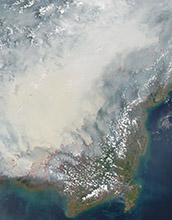
Satellite data can reveal fire susceptibility in peatlands(图)
Satellite data fire susceptibility peatlands
2019/10/18
When large areas of carbon-rich soil catch fire, the blaze emits massive amounts of carbon into the atmosphere and creates a thick haze. These blazes can usher in long-term climate impacts that affect...
MULTI-SATELLITE OBSERVATION SCHEDULING FOR LARGE AREA DISASTER EMERGENCY RESPONSE
Disaster Emergency Response Area Tasks Decomposition Multi-satellite Scheduling Multi-objective Genetic Algorithm
2018/5/15
an optimal imaging plan, plays a key role in coordinating multiple satellites to monitor the disaster area. In the paper, to generate imaging plan dynamically according to the disaster relief, we prop...
SATELLITE GUIDANCE AND CONTROL DURING OPERATIVE OPTOELECTRONIC IMAGERY FOR DISASTER MANAGEMENT
Spacecraft Guidance Attitude Determination and Control Areal Land Surveying Disaster Management
2018/4/18
We consider problems on surveying the Earth surface during operative optoelectronic imagery for disaster management with respect to attitude guidance and control of the agile spacecraft. The land surv...
pMONITORING THE URBAN GROWTH OF DHAKA (BANGLADESH) BY SATELLITE IMAGERY IN FLOODING RISK MANAGEMENT PERSPECTIVE
Dhaka flooding risk urban growth landcover Landsat
2014/4/24
There is large consensus that demographic changes, the lack of appropriate environmental policies and sprawling urbanization result
in high vulnerability and exposure to the natural disasters.
This...

